Mapping and assessing forest fire severity using remote sensing indices: A case study of Tizi Ouzou, Algeria
DOI:
https://doi.org/10.3986/AGS.14459Keywords:
wildfire, remote sensing, land surface temperature, NDVI, dNBR, Tizi Ouzou, AlgeriaAbstract
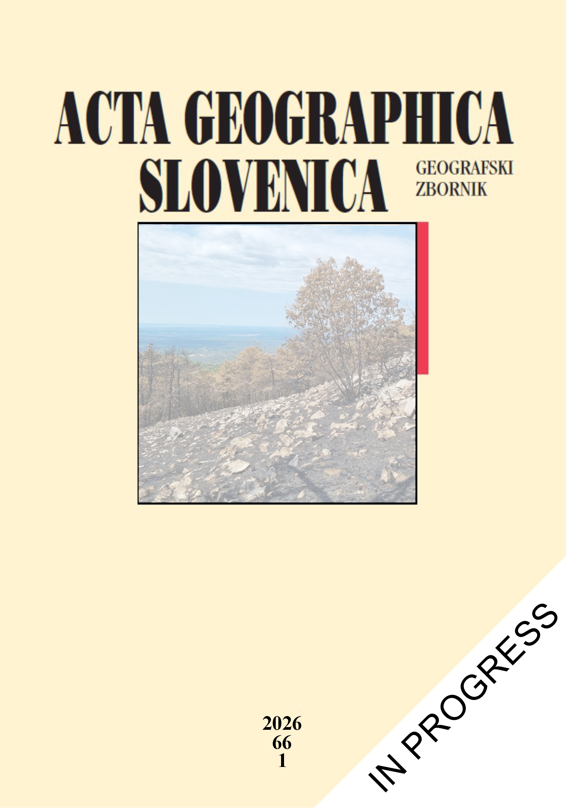
In Mediterranean regions, wildfires are exacerbated by rising temperatures and drought, stressing the need for rapid post-fire evaluation. This study employs Landsat‐8 imagery to evaluate the effects of forest fires during summer 2021 in Tizi Ouzou region, Algeria. We calculated the Normalized Burn Ratio (NBR) and its difference (dNBR) from pre- and post‐fire images, and analyzed the Normalized Difference Vegetation Index (NDVI) and Land Surface Temperature (LST) to evaluate vegetation loss and thermal response. Results indicate 24,700 hectares (~6.7%) with high severity, 55,200 ha (14.9%) with moderate–high and 94,500 ha (25.5%) with moderate–low. These findings highlight the value of combining spectral and thermal indices for wildfire assessment, offering guidance for restoration and management.
Downloads
References
Ammiche, S., Oumezzaouche, N. 2018: Valorisation des produits forestiers non ligneux dans la wilaya de Tizi‐Ouzou: cas de la forêt des Béni Ghobri. Ph.D. thesis. Université Mouloud Mammeri.
Arfa, A. M. T., Benderradji, M. E. H., Saint-Gérand, T., Alatou, D. 2019: Cartographie du risque feu de forêt dans le Nord-est algérien: cas de la wilaya d’El Tarf. Cybergeo: European Journal of Geography. https://doi.org/10.4000/cybergeo.32304
Avdan, U., Jovanovska, G. 2016: Algorithm for automated mapping of land surface temperature using LANDSAT 8 satellite data. Journal of Sensors 2016-1. https://doi.org/10.1155/2016/1480307
Belgherbi, B., Benabdeli, K., Mostefai, K. 2018: Mapping the risk of forest fires in Algeria: application of the forest of Guetarnia in Western Algeria. Ekológia 37-3. https://doi.org/10.2478/eko-2018-0022
Brewer, C. K., Winne, J. C., Redmond, R. L., Opitz, D. W., Mangrich, M. V. 2005: Classifying and mapping wildfire severity. Photogrammetric Engineering & Remote Sensing 11. https://doi.org/10.14358/PERS.71.11.1311
Cansler, C. A., McKenzie, D. 2012: How robust are burn severity indices when applied in a new region? Evaluation of alternate field-based and remote-sensing methods. Remote Sensing 4-2. https://doi.org/10.3390/rs4020456
Carlson, T. N., Ripley, D. A. 1997: On the relation between NDVI, fractional vegetation cover, and leaf area index. Remote Sensing of Environment 62-3. https://doi.org/10.1016/S0034-4257(97)00104-1
Castro-Melgar, I., Tsagkou, A., Zacharopoulou, M., Basiou, E., Athinelis, I., Katris, E. A., Kalavrezou, I. E. et al. 2025: Wildfires during early summer in Greece (2024): Burn severity and land use dynamics through Sentinel-2 data. Forests 16-2. https://doi.org/10.3390/f16020268
Chu, T., Guo, X., Takeda, K. 2016: Remote sensing approach to detect post-fire vegetation regrowth in Siberian boreal larch forest. Ecological Indicators 62. https://doi.org/10.1016/j.ecolind.2015.11.026
Chuvieco, E., Lizundia-Loiola, J., Pettinari, M. L., Ramo, R., Padilla, M., Tansey, K., Mouillot, F. et al. 2018: Generation and analysis of a new global burned area product based on MODIS 250 m reflectance bands and thermal anomalies. Earth System Science Data 10-4. https://doi.org/10.5194/essd-10-2015-2018
Chuvieco, E., Mouillot, F., Van der Werf, G. R., San Miguel, J., Tanase, M., Koutsias, N., García, M. et al. 2019: Historical background and current developments for mapping burned area from satellite Earth observation. Remote Sensing of Environment 225. https://doi.org/10.1016/j.rse.2019.02.013
Cocke, A. E., Fulé, P. Z., Crouse, J. E. 2005: Comparison of burn severity assessments using Differenced Normalized Burn Ratio and ground data. International Journal of Wildland Fire 14-2. https://doi.org/10.1071/WF04010
Conservation des forêts Tizi Ouzou 2021: Bilan annuel des incendies de forêt, Campagne 2021. Technical report.
Cook, M., Schott, J. R., Mandel, J., Raqueno, N. 2014: Development of an operational calibration methodology for the Landsat thermal data archive and initial testing of the atmospheric compensation component of a Land Surface Temperature (LST) Product from the archive. Remote Sensing 6-11. https://doi.org/10.3390/rs61111244
De Santis, A., Chuvieco, E. 2009: GeoCBI: A modified version of the Composite Burn Index for the initial assessment of the short-term burn severity from remotely sensed data. Remote Sensing of Environment 113-3. https://doi.org/10.1016/j.rse.2008.10.011
Digavinti, J., Manikiam, B. 2021: Satellite monitoring of forest fire impact and regeneration using NDVI and LST. Journal of Applied Remote Sensing 15-4. https://doi.org/10.1117/1.JRS.15.042412
Direction Générale des Forêts 2021: Bilan des incendies de forêts en Algérie. Ministère de l’Agriculture et du Développement Rural. Report.
Dupuy, J. L., Fargeon, H., Martin-StPaul, N., Pimont, F., Ruffault, J., Guijarro, M., Fernandes, P. et al. 2020: Climate change impact on future wildfire danger and activity in southern Europe: A review. Annals of Forest Science 77-2. https://doi.org/10.1007/s13595-020-00933-5
Durlević, U., Srejić, T., Valjarević, A., Aleksova, B., Deđanski, V., Vujović, F., Lukić, T. 2025: GIS-based spatial modeling of soil erosion and wildfire susceptibility ssing VIIRS and Sentinel-2 data: A case study of Šar Mountains National Park, Serbia. Forests 16-3. https://doi.org/10.3390/f16030484
Ekumah, B., Armah, F. A., Afrifa, E. K., Aheto, D. W., Odoi, J. O., Afitiri, A. R. 2020: Geospatial assessment of ecosystem health of coastal urban wetlands in Ghana. Ocean & Coastal Management 193. https://doi.org/10.1016/j.ocecoaman.2020.105226
Epting, J., Verbyla, D. Sorbel, B. 2005: Evaluation of remotely sensed indices for assessing burn severity in interior Alaska using Landsat TM and ETM+. Remote Sensing of Environment 96-3,4. https://doi.org/10.1016/j.rse.2005.03.002
Escuin, S., Navarro, R. Fernández, P. 2008: Fire severity assessment by using NBR (Normalized Burn Ratio) and NDVI (Normalized Difference Vegetation Index) derived from LANDSAT TM/ETM images. International Journal of Remote Sensing 29-4. https://doi.org/10.1080/01431160701281072
Fernandes, P. M. 2013: Fire-smart management of forest landscapes in the Mediterranean basin under global change. Landscape and Urban Planning 110. https://doi.org/10.1016/j.landurbplan.2012.10.014
Fernández-Guisuraga, J. M., Calvo, L., Quintano, C., Fernández-Manso, A., Fernandes, P. M. 2023: Fractional vegetation cover ratio estimated from radiative transfer modeling outperforms spectral indices to assess fire severity in several Mediterranean plant communities. Remote Sensing of Environment 290. https://doi.org/10.1016/j.rse.2023.113542
Ganteaume, A., Barbero, R. 2019: Contrasting large fire activity in the French Mediterranean. Natural Hazards and Earth System Sciences 19-5. https://doi.org/10.5194/nhess-19-1055-2019
García, M. L., Caselles, V. 1991: Mapping burns and natural reforestation using Thematic Mapper data. Geocarto International 6-1. https://doi.org/10.1080/10106049109354290
Gitas, I., Mitri, G., Veraverbeke, S., Polychronaki, A. 2012: Advances in remote sensing of post-fire vegetation recovery monitoring – A review. In: Remote Sensing of Biomass – Principles and Applications. IntechOpen. https://doi.org/10.5772/20571
Guehaz, R., Sivakumar, V. 2023: A case study about the forest fire occurred on 05 July 2021 over Khenchela province, Algeria, using space-borne remote sensing. Frontiers in Remote Sensing 4. https://doi.org/10.3389/frsen.2023.1289963
Harris, S., Veraverbeke, S., Hook, S. 2011: Evaluating spectral indices for assessing fire severity in chaparral ecosystems (Southern California) using MODIS/ASTER (MASTER) airborne simulator data. Remote sensing 3-11. https://doi.org/10.3390/rs3112403
Keeley, J. E. 2009: Fire intensity, fire severity and burn severity: A brief review and suggested usage. International Journal of Wildland Fire 18-1. https://doi.org/10.1071/WF07049
Key, C. H., Benson, N. C. 2006: Landscape assessment (LA). In: FIREMON: Fire effects monitoring and inventory system. General technical report. U.S. Department of Agriculture, Forest Service, Rocky Mountain Research Station.
Kouachi, M. E., Khairoun, A., Moghli, A., Rahmani, S., Mouillot, F., Baeza, M. J., Moutahir, H. 2024: Forty-year fire history reconstruction from Landsat data in Mediterranean ecosystems of Algeria following international standards. Remote sensing 16-13. https://doi.org/10.3390/rs16132500
Koutsias, N., Kalabokidis, K. D. Allgöwer, B. 2004: Fire occurrence patterns at landscape level: Beyond positional accuracy of ignition points with kernel density estimation methods. Natural Resource Modeling 17-4. https://doi.org/10.1111/j.1939-7445.2004.tb00141.x
Koutsias, N., Karamitsou, A., Nioti, F., Coutelieris, F. 2022: Assessment of fire regimes and post-fire evolution of burned areas with the dynamic time warping method on time series of satellite images—setting the methodological framework in the Peloponnese, Greece. Remote Sensing 14-20. https://doi.org/10.3390/rs14205237
Kurbanov, E., Vorobev, O., Lezhnin, S., Sha, J., Wang, J., Li, X., Cole, J. et al. 2022: Remote sensing of forest burnt area, burn severity, and post-fire recovery: A review. Remote Sensing 14-19. https://doi.org/10.3390/rs14194714
Lahmar, B., Akakba, A. 2024: Forest fire detection based on earlier pre-fire conditions using analysis hierarchic process (AHP) in a semi-arid climate. A case study: Belezma National Park, Algeria. Acta Geographica Lodziensia 114. https://doi.org/10.26485/AGL/2024/114/3
Lentile, L. B., Holden, Z. A., Smith, A. M., Falkowski, M. J., Hudak, A. T., Morgan, P., Lewis, S. A. et al. 2006: Remote sensing techniques to assess active fire characteristics and post-fire effects. International Journal of Wildland Fire 15-3. https://doi.org/10.1071/WF05097
Liu, J., Wang, Y., Guo, H., Lu, Y., Xu, Y., Sun, Y., Gan, W. et al. 2024: Spatial and temporal patterns and driving factors of forest fires based on an optimal parameter-based geographic detector in the Panxi region, Southwest China. Fire Ecology 20-1. https://doi.org/10.1186/s42408-024-00257-z
Lovreglio, R., Leone, V., Giaquinto, P., Notarnicola, A. 2010: Wildfire cause analysis: Four case-studies in southern Italy. iForest-Biogeosciences and Forestry 3-1. https://doi.org/10.3832/ifor0521-003
Lukić, T., Marić, P., Hrnjak, I., Gavrilov, M. B., Mladjan, D., Zorn, M., Komac, B. et al. 2017: Forest fire analysis and classification based on a Serbian case study. Acta geographica Slovenica 57-1. https://doi.org/10.3986/AGS.918
Maillard, O., Flores-Valencia, M., Michme, G., Coronado, R., Bachfischer, M., Azurduy, H., Vides-Almonacid, R. et al. 2022: Phenology patterns and postfire vegetation regeneration in the Chiquitania region of Bolivia using Sentinel-2. Fire 5-3. https://doi.org/10.3390/fire5030070
Meddour-Sahar, O., Derridj, A. 2010: Le risque d'incendie de forêt: évaluation et cartographie. Science et changements planétaires/Sécheresse 21-3.
Miller, J. D., Thode, A. E. 2007: Quantifying burn severity in a heterogeneous landscape with a relative version of the delta Normalized Burn Ratio (dNBR). Remote Sensing of Environment 109-1. https://doi.org/10.1016/j.rse.2006.12.006
Mouillot, F., Ratte, J. P., Joffre, R., Moreno, J. M., Rambal, S. 2003: Some determinants of the spatio-temporal fire cycle in a Mediterranean landscape (Corsica, France). Landscape Ecology 18. https://doi.org/10.1023/B:LAND.0000004182.22525.a9
Nasery, S., Kalkan, K. 2020: Burn area detection and burn severity assessment using Sentinel 2 MSI data: The case of Karabağlar district, İzmir/Turkey. Turkish Journal of Geosciences 1-2.
Nolè, A., Rita, A., Spatola, M. F., Borghetti, M. 2022: Biogeographic variability in wildfire severity and post-fire vegetation recovery across the European forests via remote sensing-derived spectral metrics. Science of The Total Environment 823. https://doi.org/10.1016/j.scitotenv.2022.153807
Oliveira, S., Oehler, F., San-Miguel-Ayanz, J., Camia, A., Pereira, J. M. 2012: Modeling spatial patterns of fire occurrence in Mediterranean Europe using Multiple Regression and Random Forest. Forest Ecology and Management 275. https://doi.org/10.1016/j.foreco.2012.03.003
Parks, S. A., Dillon, G. K., Miller, C. 2014: A new metric for quantifying burn severity: the relativized burn ratio. Remote Sensing 6-3. https://doi.org/10.3390/rs6031827
Rahmani, S., Benmassoud, H. 2019: Modelling of forest fire risk spatial distribution in the region of Aures, Algeria. Geoadria 24-2. https://doi.org/10.15291/geoadria.2846
Rouse, J. W., Haas, R. H., Schell, J. A., Deering, D. W. 1973: Monitoring the vernal advancement and retrogradation (green wave effect) of natural vegetation. Progress Report RSC 1978-2. Technical Report. NASA.
Roy, D. P., Boschetti, L., Justice, C. O., Ju, J. 2008: The collection 5 MODIS burned area product—Global evaluation by comparison with the MODIS active fire product. Remote Sensing of Environment 112-9. https://doi.org/10.1016/j.rse.2008.05.013
Roy, D. P., Wulder, M. A., Loveland, T. R., Woodcock, C. E., Allen, R. G., Anderson, M. C., Helder, D. et al. 2014: Landsat-8: Science and product vision for terrestrial global change research. Remote Sensing of Environment 145. https://doi.org/10.1016/j.rse.2014.02.001
Ru, C., Duan, S. B., Jiang, X. G., Li, Z. L., Jiang, Y., Ren, H., Leng, P. et al. 2021: Land surface temperature retrieval from Landsat 8 thermal infrared data over urban areas considering geometry effect: Method and application. IEEE Transactions on geoscience and remote sensing 60. https://doi.org/10.1109/TGRS.2021.3088482
Sabljić, L., Perić, Z. M., Bajić, D., Marković, S. B., Adžić, D., Lukić, T. 2025: Advancing wildfire monitoring: remote sensing techniques and applications in the Sana River Basin, Bosnia and Herzegovina. Natural Hazards 1-40. https://doi.org/10.1007/s11069-025-07518-3
Sahar, O., Hamel, H., Meddour, R. 2020: Etude des grands feux de forêts en Algérie: Cas de la wilaya de Tizi Ouzou. Geo-Eco-Trop 44-3.
San‑Miguel‑Ayanz, J., Durrant, T., Boca, R., Maianti, P., Libertá, G., Artés‑Vivancos, T., Oom, D. et al. 2022: Advance report on wildfires in Europe, Middle East and North Africa 2021. Technical report. Publications Office of the European Union. https://doi.org/10.2760/039729
Sobrino, J. A., Jiménez-Muñoz, J. C., Paolini, L. 2004: Land surface temperature retrieval from LANDSAT TM 5. Remote Sensing of Environment 90-4. https://doi.org/10.1016/j.rse.2004.02.003
Stathopoulou, M., Cartalis, C. 2007: Daytime urban heat islands from Landsat ETM+ and Corine land cover data: An application to major cities in Greece. Solar Energy 81-3. https://doi.org/10.1016/j.solener.2006.06.014
Stefanidis, S., Alexandridis, V., Spalevic, V., Mincato, R. L. 2022: Wildfire effects on soil erosion dynamics: The case of 2021 megafires in Greece. Agriculture & Forestry 68-2. https://doi.org/10.17707/AgricultForest.68.2.04
Tran, B. N., Tanase, M. A., Bennett, L. T., Aponte, C. 2018: Evaluation of spectral indices for assessing fire severity in Australian temperate forests. Remote Sensing 10-11. https://doi.org/10.3390/rs10111680
Turco, M., Jerez, S., Augusto, S., Tarín-Carrasco, P., Ratola, N., Jiménez-Guerrero, P., Trigo, R. M. 2019: Climate drivers of the 2017 devastating fires in Portugal. Scientific Reports 9-1. https://doi.org/10.1038/s41598-019-50281-2
United States Geological Survey 2016: Landsat – Earth Observation Satellites. Fact sheet. https://doi.org/10.3133/fs20153081
Veraverbeke, S., Hook, S., Hulley, G. 2012: An alternative spectral index for rapid fire severity assessments. Remote Sensing of Environment 123. https://doi.org/10.1016/j.rse.2012.02.025
Veraverbeke, S., Lhermitte, S., Verstraeten, W. W., Goossens, R. 2010: The temporal dimension of differenced Normalized Burn Ratio (dNBR) fire/burn severity studies: The case of the large 2007 Peloponnese wildfires in Greece. Remote Sensing of Environment 114-11. https://doi.org/10.1016/j.rse.2010.05.029
Vlassova, L., Pérez-Cabello, F., Mimbrero, M. R., Llovería, R. M., García-Martín, A. 2014: Analysis of the relationship between land surface temperature and wildfire severity in a series of Landsat images. Remote Sensing 6-7. https://doi.org/10.3390/rs6076136
Vujović, F., Valjarević, A., Vila-Subirós, J., Šiljeg, A., Lukić, T. 2024: Geospatial modeling of wildfire susceptibility on a national scale in Montenegro: A comparative evaluation of F-AHP and FR methodologies. Open Geosciences 16-1. https://doi.org/10.1515/geo-2022-0694
Wasserman, T. N., Mueller, S. E. 2023: Climate influences on future fire severity: A synthesis of climate-fire interactions and impacts on fire regimes, high-severity fire, and forests in the western United States. Fire Ecology 19-1. https://doi.org/10.1186/s42408-023-00200-8
Wendt, C. K., Beringer, J., Tapper, N. J., Hutley, L. B. 2007: Local boundary-layer development over burnt and unburnt tropical savanna: An observational study. Boundary-Layer Meteorology 124. https://doi.org/10.1007/s10546-006-9148-3
Yuan, F., Bauer, M. E. 2007: Comparison of impervious surface area and normalized difference vegetation index as indicators of surface urban heat island effects in Landsat imagery. Remote Sensing of Environment 106-3. https://doi.org/10.1016/j.rse.2006.09.003
Zahabnazouri, S., Belmont, P., David, S., Wigand, P. E., Elia, M., Capolongo, D. 2025: Detecting burn severity and vegetation recovery after fire using dNBR and dNDVI indices: Insight from the Bosco Difesa Grande, Gravina in Southern Italy. Sensors 25-10. https://doi.org/10.3390/s25103097
Zennir, R., Khallef, B. 2023: Forest fire area detection using Sentinel-2 data: Case of the Beni Salah national forest‒Algeria. Journal of Forest Science 69-1. https://doi.org/10.17221/50/2022-JFS
Zhao, Y., Huang, Y., Sun, X., Dong, G., Li, Y., Ma, M. 2023: Forest fire mapping using multi-source remote sensing data: A case study in Chongqing. Remote Sensing 15-9. https://doi.org/10.3390/rs15092323
Zikiou, N., Rushmeier, H., Capel, M. I., Kandakji, T., Rios, N., Lahdir, M. 2024: Remote sensing and machine learning for accurate fire severity mapping in northern Algeria. Remote Sensing 16-9. https://doi.org/10.3390/rs16091517
Downloads
Published
How to Cite
Issue
Section
License
Copyright (c) 2026 Fouzia Boudjemline

This work is licensed under a Creative Commons Attribution-ShareAlike 4.0 International License.


