
Morphometric analysis of dolines — the problem of delineation and calculation of basic parameters
DOI:
https://doi.org/10.3986/ac.v47i1.4941Ključne besede:
kras, določanje oboda vrtač, morfometrične analize, merske napake, otok KrkPovzetek
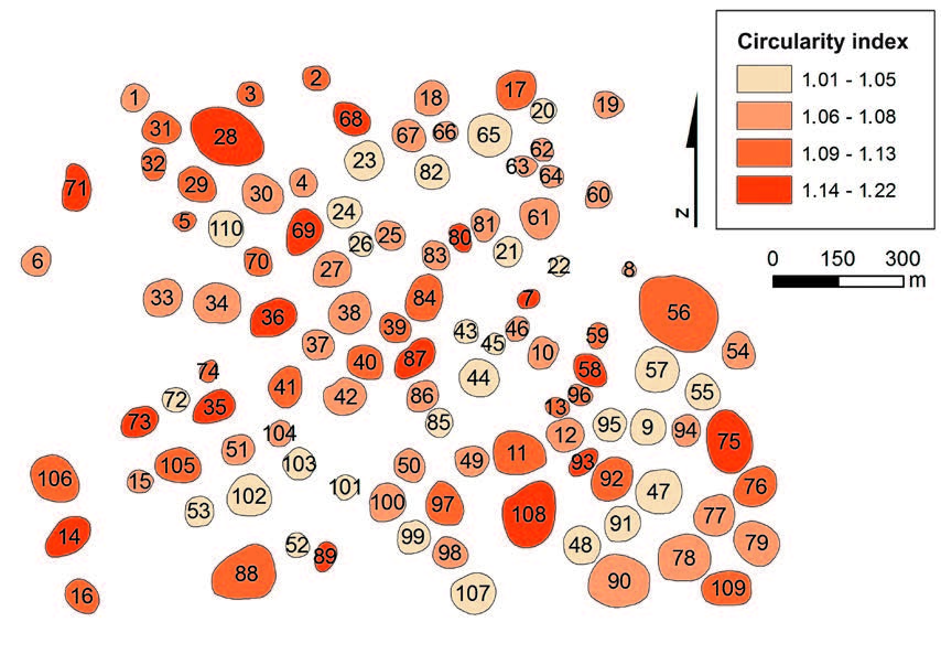
Unstable correlations between environmental settings and doline geometry have inspired a revision of previously applied doline delineating methods, and the adequacy of morphometric analysis that follows from such input data. We examine reliability of the most accessible data sources for remote doline delineation, namely basic topographic maps at scale of 1:5,000 and ortho-rectified aerial photographs (digital orthophotos) of 0.5 m resolution. Their reliability has been quantified in the Dinaric karst (Krk Island, NE Adriatic Sea). The adequacy of most commonly used morphometric parameters (viz. elongation and circularity) and their variations applied in previous studies are mathematically verified and practically tested. The optimal variation of an individual parameter (circularity = Pcc/Pd ; elongation = ε of the best fitting ellipse) is identified and suggested for use in order to provide uniform results and increase the comparability of future morphometric analyses. Asymmetry as an additional parameter for describing doline ground plans has been developed and is proposed for use in further research.
Prenosi
Prenosi
Objavljeno
Kako citirati
Številka
Rubrike
Licenca
Avtorji jamčijo, da je delo njihova avtorska stvaritev, da v njem niso kršene avtorske pravice tretjih oseb ali kake druge pravice. V primeru zahtevkov tretjih oseb se avtorji zavezujejo, da bodo varovali interese založnika ter da bodo povrnili morebitno škodo.
Podrobneje v rubriki: Prispevki

