
Polavtomatski pristop za kartiranje vrtač na brazilskem pokritem krasu: pot do ocene ranljivosti
DOI:
https://doi.org/10.3986/ac.v51i1.10011Ključne besede:
povezanost med jamami in tlemi, območje varstva, terensko raziskovanje, daljinsko zaznavanjePovzetek
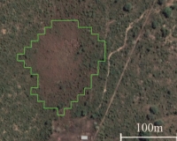
Kartiranje vrtač je nadvse pomembno za oceno ranljivosti in tveganja podzemnega kraškega okolja, saj določa točke povezanosti med jamami in tlemi na površju. Vendar je ročno kartiranje zelo zahtevno, časovno zamudno in subjektivno, zlasti v velikih merilih. Zato je bil v tej študiji uporabljen polavtomatski pristop z uporabo orodij GIS za kartiranje velikih in srednje velikih kraških globeli/vrtač v porečju reke Corrente v Braziliji s posebnim poudarkom na okoljsko ohranjenih območjih reke Vermelho (portugalsko APANRV) z uporabo daljinskega zaznavanja (posnetki DEM in programa Google Earth) in na podlagi terenskih opazovanj. Na podlagi obsežnih terenskih raziskav je ugotovljenih sedem značilnih oblik vrtač (npr. kokpit z drenažo, udornica, udornica z zajezitvijo reke, sufozija, škavnica, udornica, nastala z udorom/rušenjem jamskega stropa, in udornice, nastale z zasutjem). Kot rezultat predlaganega pristopa je bilo opredeljenih 232 srednje velikih do velikih vrtač, ki so bile glede na gostoto vrtač in lokalno geologijo razvrščene v tri glavne skupine G1, G2 in G3. Velika gostota opredeljenih vrtač (164 znanih jam) v skupini G1 zagotavlja predhodni pregled za prihodnja speleološka dela na ohranjenih območjih. Poleg tega prisotnost velikega števila vrtač na sosednjih območjih (G2 in G3) poudarja potrebo po ponovnem pregledu zdajšnjih meja APANRV. Rezultati se dobro ujemajo z lokacijami vrtač, kartiranimi na podlagi terenskih raziskav in posnetkov programa Google Earth. To kartiranje vrtač lahko raziskovalcem pomaga pri oceni ranljivosti podzemne vode in pri zaščiti speleološke dediščine, ohranjene v jamah.
Prenosi
Prenosi
Objavljeno
Kako citirati
Številka
Rubrike
Licenca

To delo je licencirano pod Creative Commons Priznanje avtorstva-Nekomercialno-Brez predelav 4.0 mednarodno licenco.
Avtorji jamčijo, da je delo njihova avtorska stvaritev, da v njem niso kršene avtorske pravice tretjih oseb ali kake druge pravice. V primeru zahtevkov tretjih oseb se avtorji zavezujejo, da bodo varovali interese založnika ter da bodo povrnili morebitno škodo.
Podrobneje v rubriki: Prispevki

