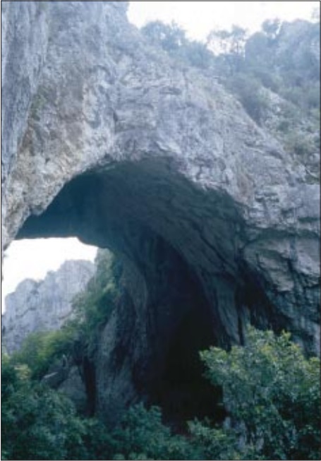
Natural Bridges on the Vratna River (Eastern Serbia) as the Last Remnants of a Former Cave
DOI:
https://doi.org/10.3986/ac.v29i2.463Abstract
Reka Vratna, ki ima porečje na zahodnem robu dačanske kotline, je desni pritok Donave. Od skupaj 22 km dolgega toka teče v dolžini 3,5 km skozi sotesko, vrezano v titonijske apnence. Preko soteske se pnejo 3 naravni mostovi, ki skupaj pokrivajo 94 m rečnega toka. Zelo verjetno sta 2 od teh mostov ostanek nekdanjega jamskega stropa. Zaradi denudacijskih procesov in porušenega ravnotežja se je skoraj ves jamski strop udrl, razen dveh delov. V soteski je tudi nekaj kratkih jam in spodmolov. Najdaljša jama (305 m) je ravno za največjim od mostov.
The Vratna River is a right-side tributary of the Danube and its drainage area is situated at the western rim of the Dacian Basin. Along its 22 km long course, the Vratna flows through a 3,5 km long gorge cut in Tithonian limestones. Across the gorge there are three natural bridges, which shelter, in total 94 metres of the river course. There is a strong assumption that two of the natural bridges are the only remaining parts of roof of a former cave. Due to the process of surface denudation and to the disruption of stability, the cave roof almost completely collapsed, with the exception of these two sections. Several short caves and rock shelters exist in the gorge, and the longest cave (305 m) is situated next to the biggest of the three natural bridges.
Downloads

Downloads
Published
How to Cite
Issue
Section
License
Authors guarantee that the work is their own original creation and does not infringe any statutory or common-law copyright or any proprietary right of any third party. In case of claims by third parties, authors commit their self to defend the interests of the publisher, and shall cover any potential costs.
More in: Submission chapter


