Main hydrological features and recharge analysis of the Caposele Spring catchment, southern Italy
DOI:
https://doi.org/10.3986/ac.v48i1.6738Keywords:
karst aquifer, recharge model, spring discharge, storage, southern ItalyAbstract
Main hydrological features and recharge analysis of the Caposele Spring catchment, southern Italy
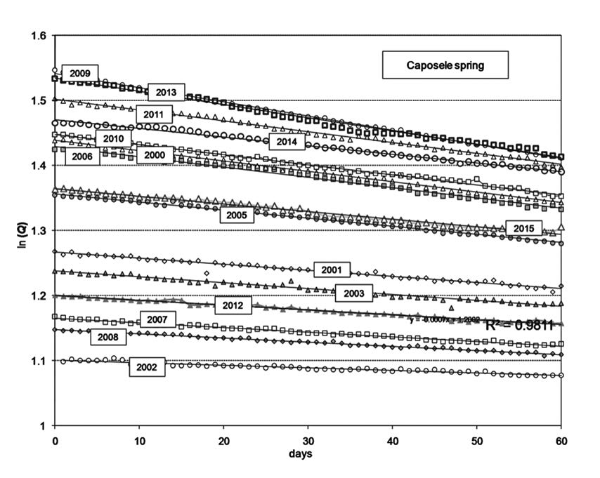
The Caposele spring supplies with water the Puglia region (southern Italy) since the beginning of the twentieth century by a wide and long (about 400 km) gravity-aqueduct system. Systematic spring discharge measurements exist since 1920. The annual mean discharge of spring is about 4 m3/sec, the spring catchment of the of Mt. Cervialto karst massif is estimated on more than 100 km2. The spring regime is characterised by absence of abrupt peaks in the hydrographs; the flood period occurs in spring-summer time, and the minimum during the autumn-winter time. Thus, the regime is almost opposite that of rainfall which allows a convenient management of the source. The historical data have shown that spring discharge depends also on the hydrological conditions of the previous year because the ‘‘memory effect” of aquifer. The recharge processes have been evaluated using a daily scale recharge model, calibrated on long term annual scale. The results allow to estimate the inertial behaviour of the aquifer, by the difference of recharged and discharged water volume during a hydrological year: after a wet year, an amount of water volume is retained into the aquifer and constitutes the surplus volume stored; after a dry year, the aquifer discharges a water volume higher than the recharged volume (a deficit in storage).
Key words: karst aquifer, recharge model, spring discharge, storage, southern Italy.
Glavne hidrološke značilnosti in analiza napajanja zaledja izvira Caposele, južna Italija
Izvir Caposele je od začetka 20. stoletja glavni vodni vir Apulije (južna Italija). Voda je od izvira do mest gravitacijsko speljana po približno 400 km dolgem akvaduktu. Sistematične meritve pretoka potekajo od leta 1920, povprečni pretok izvira je 4 m3/s, območje napajanja je kraški masiv gore Cervialto s površino preko 100 km2. Značilnosti izvira so odsotnost izrazitih vrhov v pretočnem hidrogramu, visok pretok v pomladansko-poletnem času in nizek pretok v jesensko-zimskem obdobju. Režim pretoka izvira je skoraj obraten od padavin, kar omogoča preprosto upravljanje vodnega vira. Zgodovinski podatki kažejo, da je pretok odvisen od hidroloških razmer v predhodnem letu, kar je posledica velikega »spominskega učinka« vodonosnika. Napajanje sistema smo ocenili na podlagi dnevnega modela napajanja, umerjenega na dolgoročno letno obdobje. Z razliko med napajanjem in odtokom v hidrološkem letu, smo ocenili inercijsko obnašanja vodonosnika. Izkaže se, da se v letu z veliko padavinami presežek napajanja skladišči v vodonosniku, v suhem letu pa je volumen odtoka večji od volumna odtoka.
Ključne besede: kraški vodonosnik, model napajanja, pretok izvira, skladiščenje, južna Italija.
Downloads

Downloads
Published
How to Cite
Issue
Section
License
Authors guarantee that the work is their own original creation and does not infringe any statutory or common-law copyright or any proprietary right of any third party. In case of claims by third parties, authors commit their self to defend the interests of the publisher, and shall cover any potential costs.
More in: Submission chapter


