
Laser scanning technology for the hypogean survey: the case of Santa Barbara karst system (Sardinia, Italy)
DOI:
https://doi.org/10.3986/ac.v40i1.29Abstract
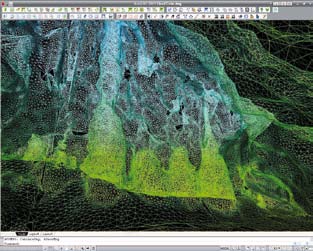
The morphological knowledge of the territory, bothin its surface and subterranean aspects, is the main premise to all decision-making procedures as well as all planning and management activities. Knowledge takes shape into reliable precise and complete thematic cartography and databases, whichare necessary for anybody dealing withunderground contexts: speleologists, scientists, public administrations, managing authorities etc. Surveys in caves are normally carried out withtraditional techniques and instruments, whichare essential for a first representation but not enoughfor a pragmatic effective topographic approach. Laser scanning technique can be an alternative to the traditional systems. Laser scanning quickly acquires the shape of cavities as “point clouds” (x, y, z coordinates and colour values) and produces a highprecision database of the surveyed object. Laser scanning technology is therefore a feasible way to document caves in a precise exhaustive way, limiting risks relating to lack and/or inadequacy of data. The present paper explains the laser scanning survey carried out in San Giovanni mine near Iglesias (Sardinia, Italy), particularly in Santa Barbara and Santa Barbara 2 caves, the data post-processing and three-dimensional modelling of “point clouds” (operations performed witha dedicated software), and the use of the obtained digital model. Moreover, the paper describes the advantages of laser scanning for the hypogean survey in comparison to traditional methods and the future potentialities of a broad application of laser scanning instruments in caves.
Downloads
Downloads
Published
How to Cite
Issue
Section
License
Authors guarantee that the work is their own original creation and does not infringe any statutory or common-law copyright or any proprietary right of any third party. In case of claims by third parties, authors commit their self to defend the interests of the publisher, and shall cover any potential costs.
More in: Submission chapter

