Investigating Ancient Maya Agricultural Adaptation Through Ground Penetrating Radar (GPR) Analysis of Karst Terrain, Northern Yucatán, Mexico
DOI:
https://doi.org/10.3986/ac.v39i1.118Abstract
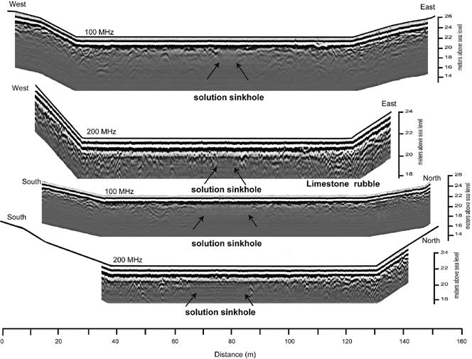
Landscape adaptation on the Northern Yucatán Peninsula, Mexico, is particularly difficult, as soils are thin and the terrain is devoid of any surface water other than the occasional sinkhole (cenote) that connects directly to the groundwater system. Despite this, ancient Maya cities, including Xuenkal, emerged and thrived, likely because of their proximity to natural sinkholes. In the case of Xuenkal, these sinkholes, known locally as rejolladas, have bases above the local water table and, as such, do not provide direct access to the underlying water, but they provide closer access. Recognizing that the presence of rejolladas was likely important to the ancient Maya the purpose of this study is to characterize the rejolladas in terms of their subsurface characteristics, specifically bedrock configuration and soil. Ground penetrating radar analysis, as well as the results of a test pit excavation, confirm the presence of deep soils in the rejollada bases. It seems that the smaller deeper rejolladas have the thickest soils and sediment. The ancient city of Xuenkal is constructed amidst a particularly dense cluster of rejolladas which may have contributed to its location. Rejolladas, containing significantly thicker soils than the surrounding karst surface, and the ability to sustain dense healthy vegetation would have been particularly desirable for the Maya to capitalize on.
Downloads

Downloads
Published
How to Cite
Issue
Section
License
Authors guarantee that the work is their own original creation and does not infringe any statutory or common-law copyright or any proprietary right of any third party. In case of claims by third parties, authors commit their self to defend the interests of the publisher, and shall cover any potential costs.
More in: Submission chapter


